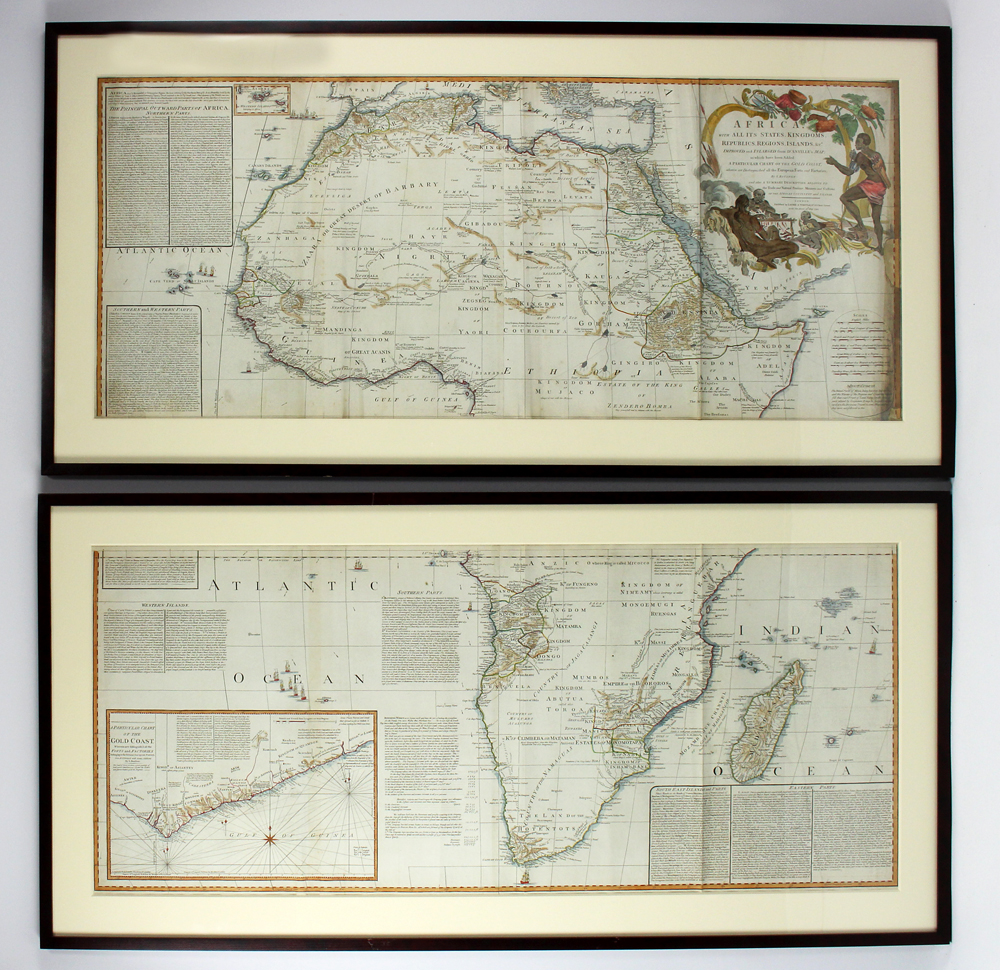
18TH C. MAP, AFRICA AND THE GOLD COAST, BOULTON
Samuel Bolton (fl. 1775 - 1800)
one large map horizontally cut in half, halves framed separately
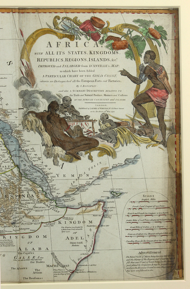
AFRICA WITH ALL ITS STATES, KINGDOMS, REPUBLICS, REGIONS, ISLANDS...IMPROVED and INLARGED from D'ANVILLE'S MAP....by S. Boulton...Published by LAURIE & WHITTLE...London...as the Act directs 12th May 1794;
A PARTICULAR MAP OF THE GOLD COAST...From D'ANVILLE with may additions by S. Boulton, both 20.5 by 47 in. (sight); matted, framed under glass, 27 by 54 in.
From the John DeWitt Pratt estate, Cambridge, MA.
This map is unique in that it is a serious attempt to compile all of the accurate scientific knowledge of the African continent available at the time, and it does provide a wealth of information both in the form of a gazetteer printed in framed text boxes here and there, as well as political and geographical features. The cartographer attempts to depict both known and unknown parts of the continent with actual data reported by both contemporary and ancient travelers.
Colors vivid. Creases where folded.
Estimate: $600 - $800
Realized: $175 - Excluding Buyer's Premium
NOTE: We cannot approve bidders during the auction. Please register as soon as possible.
Absence of a condition statement does not imply the lot is in perfect condition, free from flaws, restoration, or the effects of aging. Condition requests can be obtained via email or telephone to our gallery. Any condition statement given either verbally or written is only an opinion and should not be treated as a statement of fact. CRN bears no responsibility for error or omission. All items are sold as is. All sales are final.
Lot 140 : 18TH C. MAP, AFRICA AND THE GOLD COAST, BOULTON
Click on image to enlarge, then click on right or left side of image to view slideshow.